TECHNOLOGY EXPLAINER
Drone Communication, Positioning and Collision Avoidance
— How an aircraft that its pilot cannot see stays connected, knows where it is, avoids traffic and announces itself
How far a drone can fly is not decided by batteries and wings alone. To fly where the pilot cannot see it (beyond visual line of sight), (1) the control link (C2 link) must hold, (2) the aircraft must know its position, (3) it must detect and avoid other aircraft, and (4) it must tell people around it who it is. This article is written for materials engineers with no background in communications or navigation. It explains these four mechanisms with diagrams, and uses official documents such as the Federal Register to show where the US rules (Remote ID and the proposed beyond-visual-line-of-sight rule) stand as of the check date.
This article does not rank equipment or countries, and gives no legal advice. Accuracy figures come with how they were measured and under what conditions. Checked on 25 October 2026.
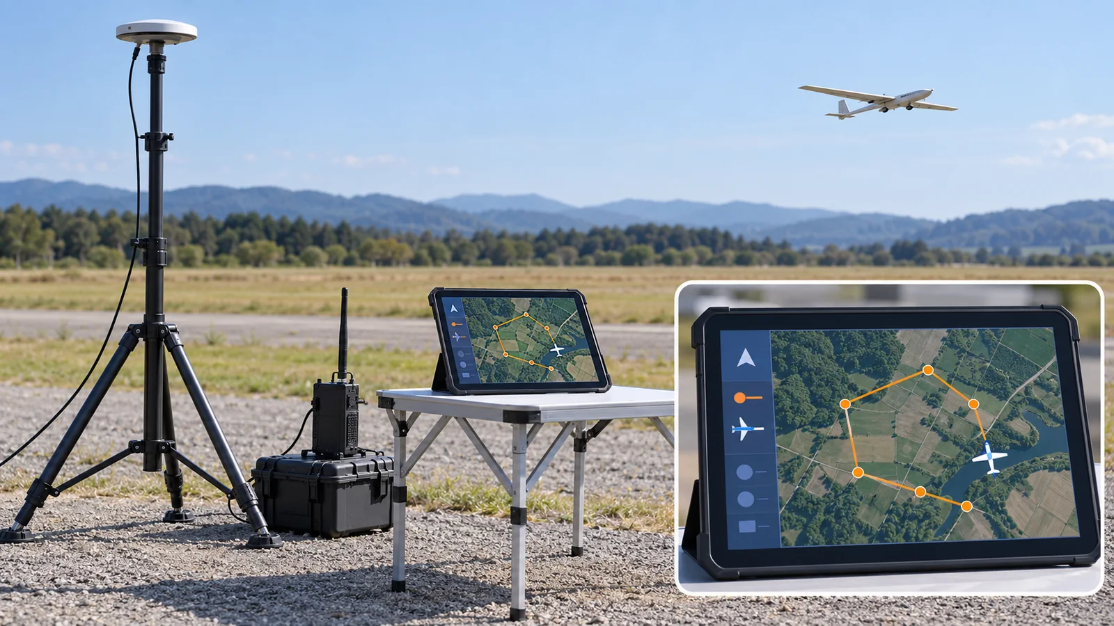
- Three-line summary / Before you read / Place in the series
- Big picture: four things stand in for the pilot’s eyes
- (1) The control link (C2)
- (2) Knowing position (satellite positioning, RTK)
- (3) Detecting and avoiding traffic
- (4) Announcing yourself (Remote ID)
- Beyond visual line of sight (BVLOS) and where the US rules stand
- A materials engineer’s view, and what we could not confirm
- How to read the yardsticks and standards / Glossary / References / Claim-to-source audit
Sourced = stated in a published source (link given)
Our calculation = a value this article calculated from stated assumptions
Not yet confirmed = plans, proposals, targets and other things not yet settled
Our own readings are marked as commentary, and Inference is shown in bold.
Positioning accuracy figures differ in how they are measured (radius or 95%, signal only or receiver included) and in conditions (open sky or not), so they cannot simply be lined up. For rules, we separate proposal, final rule and entry into force. The US proposed rule for beyond-visual-line-of-sight flight (Part 108) was still a proposal on the check date (25 October 2026); we found no final rule in the Federal Register. For legal effect and what your own operation needs, consult the text of the rules and the authority.
1. Three-line summary / Before you read / Place in the series
- Flying beyond sight takes four substitutes for the pilot’s eyes: communication (C2 link), positioning, detect and avoid (DAA), and identification (Remote ID). US rule 14 CFR 107.31 requires that small unmanned aircraft be seen by the pilot throughout the flight, to know its location, attitude and the surrounding traffic; replacing this “seeing” with technology is the heart of beyond-visual-line-of-sight flight [Reference 10]. Sourced
- Satellite positioning is powerful but has weak points: the FAA explains that civil GNSS signals are weak, unencrypted and unauthenticated, so they are vulnerable to jamming and spoofing [Reference 5]. Accuracy numbers come with conditions: about a 4.9 m radius for a smartphone versus about 2 cm for RTK are measured differently [References 1, 3].
- The rules are at different stages: Remote ID has a final rule, published on 15 January 2021 [Reference 8]. The beyond-visual-line-of-sight proposed rule (Part 108) was proposed on 7 August 2025 and its comment period reopened on 28 January 2026, but no final rule was found on the check date [References 11-13].
All you need is a feel for how radio reaches some places and not others. Viewing a drone as a combination of sensing, thinking (control and intelligence) and moving (actuators) is explained in our “Introduction to Drones and Robotics”. This article covers the “sensing” part and the exchange with the outside world.
How aircraft stay up is in our explainers on multicopter principles and on fixed-wing, VTOL and long-endurance flight. Self-localisation and camera understanding are in “SLAM and Self-Localisation” and “Robot Vision and Perception”, LiDAR in “LiDAR”, delivery operations in “Drone Logistics”, and the overall rules in “Drone Regulation and Airspace Management”. This article covers the technologies of connecting, knowing, avoiding and announcing.
2. Big picture: four things stand in for the pilot’s eyes
Start with an everyday analogy. When we cycle along an unfamiliar road, we (1) keep in touch with someone by phone, (2) check our position on a map app, (3) watch oncoming cars and people and avoid them, and (4) make ourselves noticed with a light and a bell. When a drone flies where its pilot cannot see it, machines do all of this.
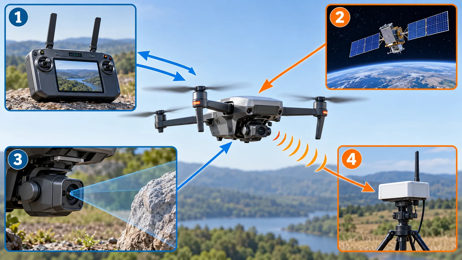
Original SVG, detailed explanation and sources
Original SVG reference: Concept diagram (vector drawing). What a drone connects to, and how it knows, avoids and identifies. Arrows show the flow of information, not signal strength or distance.
Visual line of sight (VLOS) means a person flies the aircraft while watching it with their own eyes. Beyond visual line of sight (BVLOS) means flying farther than can be seen. US rule 14 CFR 107.31 requires that the remote pilot and others, with vision unaided by any device other than corrective lenses, can see the aircraft throughout the flight in order to (1) know its location, (2) determine its attitude, altitude and direction, (3) observe the airspace for other traffic or hazards, and (4) determine that it does not endanger life or property [Reference 10]. Sourced Replacing these four with communication, positioning, DAA and identification technology is the way of thinking behind BVLOS (commentary).
3. (1) The control link (C2)
The C2 link carries the pilot’s commands and the aircraft’s status (position, battery, faults). There are three main ways to connect (Fig. 3).
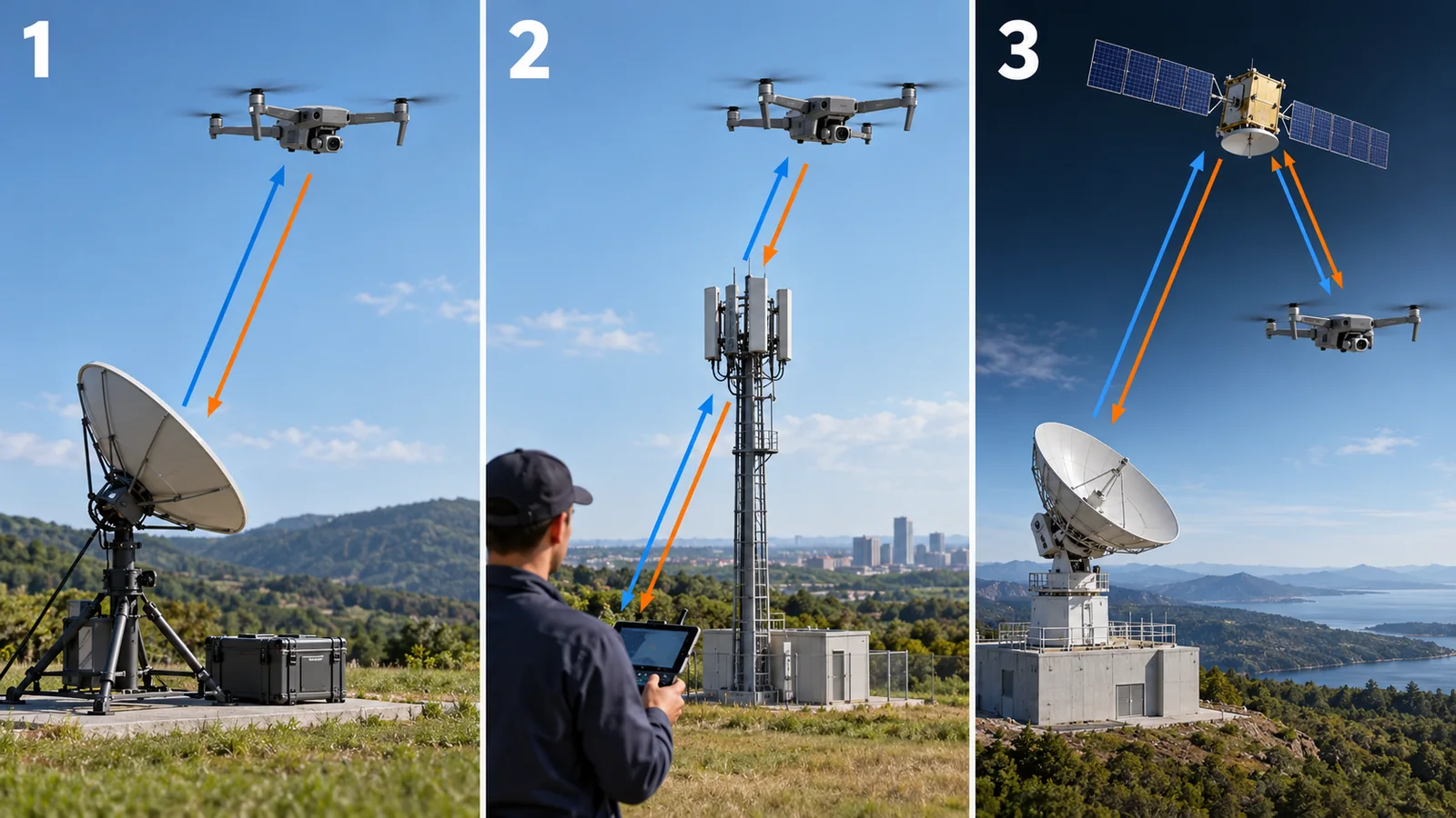
Original SVG, detailed explanation and sources
Original SVG reference: Concept diagram (vector drawing). Three ways to carry the C2 link. The strengths and weaknesses are general tendencies arranged for beginners, not the performance of any product.
The problems are delay and dropouts. To feel how much delay matters, take an aircraft flying at 15 m/s: during a 1 s delay it moves 15 m. Our calculation What the aircraft does when the link drops (lost link) — hold, return, or land — has to be decided in advance. RTCA’s list of standards includes guidance on lost C2 link procedures (DO-400), minimum aviation system performance standards for C2 link systems (DO-377) and TSO-C213a for the control and non-payload communications terrestrial link system (we checked titles only, not the requirements) [Reference 7]. Sourced
The radio frequency, the “road” of the signal, also matters. In a final rule of 8 January 2025, the US Federal Communications Commission (FCC) created dedicated frequency assignment for control-related communications (a new part 88) in part of the 5030-5091 MHz band, with dynamic frequency management systems giving operators temporary assignments. Some sections have delayed effective dates, to be announced later by the FCC in the Federal Register [Reference 6]. Sourced
Carbon-fibre-reinforced plastic (CFRP), which makes airframes light and strong, is electrically conductive, so it tends to block or reflect radio waves (commentary). Putting an antenna inside the airframe can reduce sensitivity; antenna position, windows (radomes) of radio-transparent glass-fibre plastic and distance from metal parts all affect range. Lightness and radio transparency are hard to get together through material choice. For airframe materials, see “Structural Materials for Robots and Drones”.
4. (2) Knowing position (satellite positioning, RTK)
The idea of GNSS (satellite positioning) is to learn the distance to a satellite from the time a radio signal takes to arrive. With distances to three satellites, the point where the circles (in reality spheres) of those distances cross is your position (Fig. 4).
As the right of Fig. 4 shows, a clock error of 1 nanosecond (one billionth of a second) means about 30 cm of range error. Our calculation That is why the receiver also solves for its own clock error and in practice needs four or more satellites (commentary).
Reading accuracy numbers
So how accurate is it? GPS.gov says GPS-enabled smartphones are typically accurate to within a 4.9 m (16 ft) radius under open sky, and that signal blockage by buildings, bridges and trees, reflections (multipath) and radio interference make it worse [Reference 1]. Sourced The GPS performance table, on the other hand, lists “horizontal error 8 m or less (95%, global average)” [Reference 2]. But GPS.gov explains that this commitment applies to the signal the satellites transmit, not to a receiver’s accuracy [Reference 1]. Sourced
The method aiming at centimetres is RTK (real-time kinematic). It subtracts the signals of a nearby base station (a receiver at a known position) from your own to cancel common errors. A comparison table in an arXiv paper lists RTK at 0.02 m accuracy with about 20 s convergence and regional coverage, notes that wide areas need a dense network of base stations, and that integrity (confidence that the result is right) is not natively provided (typical values for automotive use) [Reference 3]. Sourced In Japan, the CLAS (Centimeter Level Augmentation Service) of Michibiki (the Quasi-Zenith Satellite System) sends augmentation data on the L6D signal and aims at errors of several centimetres, using data from reference stations of the Geospatial Information Authority of Japan [Reference 4]. Sourced
What is actually true: civil GNSS signals are weak and have no encryption or authentication. The FAA explains that jamming and spoofing are easy and that most receivers “blindly trust” the signals they get [Reference 5]. Sourced Designs therefore avoid relying on satellites alone (combining cameras, inertial sensors and barometers). Self-localisation is covered in our “SLAM and Self-Localisation”.
The magnetic compass that gives a drone its heading is affected by the permanent magnets of the motors and the magnetic fields of heavy-current wiring (commentary); strong-magnet materials are in “Permanent Magnets and Rare Earths”. Noise from digital circuits and switching power supplies can also disturb reception of the faint GNSS signal (commentary). Shielding, a metal plate under the antenna (ground plane), and the layout of wiring and parts decide how stable positioning is. Materials and part layout create the “quietness” of electronics, which is where a materials engineer comes in.
5. (3) Detecting and avoiding traffic
Detect and avoid (DAA) is the function of finding approaching aircraft and avoiding them. Sensors and software replace the “see and avoid” that a human pilot does with their eyes. The flow has four stages: detect, track, decide, avoid (Fig. 6).
There are two ways to find another aircraft: cooperative (the other aircraft transmits its position, as with ADS-B) and non-cooperative (found by radar or cameras even if it transmits nothing). Cooperative sensing tends to be light and cheap, but cannot see aircraft that do not transmit. Non-cooperative sensing can find them, but is heavy and needs power and processing (commentary). RTCA’s list of standards includes the minimum operational performance standards for DAA (DO-365) with the FAA’s TSO-C211, air-to-air radar DO-366 with TSO-C212, ground-based surveillance DO-381 and electro-optical/infrared sensors DO-387 [Reference 7]. Sourced We checked titles only, not performance requirements.
To feel the time margin: two aircraft approaching head-on at 50 m/s each close at 100 m/s. If the other aircraft is found 1 km away, the margin is about 10 seconds. Our calculation The challenge is how far a small aircraft, with its limited weight and power, can see. For LiDAR principles, see our “LiDAR”.
Even with “detect and avoid”, who finally avoids (the aircraft automatically or a remote pilot) depends on the type of operation. Another question is how to decide who gives way (right-of-way). When the FAA reopened the comment period on 28 January 2026, it asked for further comments on exactly these topics, electronic conspicuity and right-of-way [Reference 12]. Sourced
6. (4) Announcing yourself (Remote ID)
Remote ID is a mechanism by which an aircraft broadcasts by radio “who I am and where I am”, like a licence plate combined with an electronic display. Limit of the analogy: a licence plate can be read by eye, but Remote ID needs a compatible receiver.
The FAA rule (14 CFR Part 89) lists what a standard Remote ID aircraft must at least be capable of broadcasting: (1) the identity of the aircraft (a manufacturer-assigned serial number or a session ID), (2) latitude, longitude and altitude of the control station, (3) latitude, longitude and altitude of the aircraft, (4) velocity, (5) a UTC time mark and (6) emergency status [Reference 9]. Sourced The final rule was published on 15 January 2021 (86 FR 4390), and the operator compliance deadline was 16 September 2023 [References 8, 15]. The FAA then announced that, for non-compliance on or before 16 March 2024, it would weigh circumstances such as the supply and cost of broadcast modules when deciding on enforcement [Reference 14]. Sourced Other countries’ systems, such as Japan’s, are covered in our “Drone Regulation and Airspace Management”.
7. Beyond visual line of sight (BVLOS) and where the US rules stand
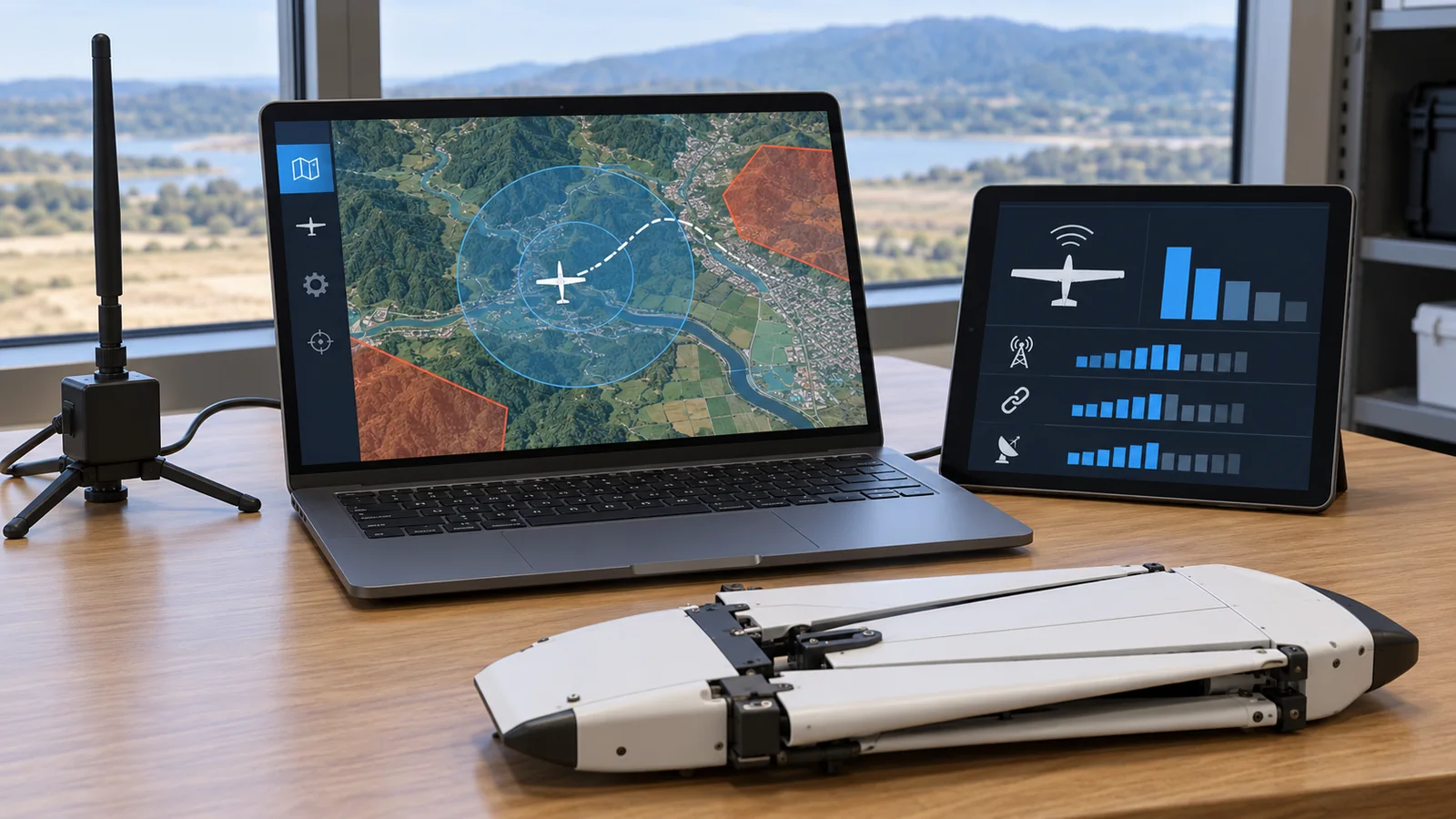
The four technologies so far stack up as layers of BVLOS (Fig. 7). The management layer (UTM) is the coordination system that lets several operators share the sky.
On 7 August 2025 the FAA published a performance-based proposed rule for low-altitude beyond-visual-line-of-sight operations and for third-party services that support them, including UTM (90 FR 38212). This is a proposal and has no legal force yet [Reference 11]. Sourced The comment period was reopened on 28 January 2026, and on 10 February 2026 a request for extension was denied [References 12, 13]. As of the check date we did not find a final rule in the Federal Register. Not yet confirmed We do not state when it may be finalised because we could not confirm it.
8. A materials engineer’s view, and what we could not confirm
Communication, positioning and DAA all use radio or light. The airframe materials therefore have to be split into places that let signals through (antenna windows, radar covers, camera windows) and places that block them (shields around noise sources). Low-dielectric-loss resins, conductive paints and gaskets, and light electromagnetic shielding are materials challenges that must be reconciled with weight saving (commentary).
What we could not confirm
- The text (requirements) of the RTCA standards, and the latest version status of TSO-C211 and TSO-C213a (titles only).
- Measured accuracy of RTK and CLAS on drones (our sources are typical values for automotive use and an official page’s wording).
- The effective dates of the delayed sections of FCC part 88 (the FCC is to announce them later).
- When Part 108 will be finalised, and its final content.
- The current edition status of ISO 21384-3 (operational procedures): the ISO pages showed inconsistent editions and could not be opened directly.
- Remote ID and BVLOS rules in Japan and Europe (covered in our “Drone Regulation and Airspace Management”).
9. How to read the yardsticks and standards
Communication, positioning, DAA and identification are measured by how rarely the link drops and how long it is delayed, position accuracy and integrity (how well errors are noticed), detection range and few missed detections, and the items broadcast. The key point is that accuracy (how close on average) and integrity (whether you notice when it is wrong) are different things. The RTK comparison table also says integrity is not natively provided [Reference 3].
| What is measured | Typical test or benchmark (name, source) | Standard, rule or guidance (name, source checked) | Reading note |
|---|---|---|---|
| C2 link | Not confirmed | RTCA DO-377 (MASPS for C2 link systems), DO-400 (guidance on lost C2 link procedures), TSO-C213a (titles only) [Reference 7] / FCC part 88 (5030-5091 MHz band) [Reference 6] Sourced | Separate voluntary standards from rules that make them mandatory. Requirement values not confirmed |
| Positioning accuracy | GPS performance commitment (horizontal 8 m or less, 95%, global average) [Reference 2]; FAA measurement (good single-frequency receivers 1.82 m or less, 95%) [Reference 1] Sourced | RTCA DO-397 (guidance on navigation gaps for UAS, title only) [Reference 7] / ASTM standards were not consulted | Signal performance is not user accuracy. Check conditions (sky view, receiver) |
| Positioning robustness | Tests of resistance to jamming and spoofing: not confirmed | FAA explanatory material (vulnerability of civil GNSS signals) [Reference 5] Sourced | Check whether the design relies on satellites alone |
| Detect and avoid | Not confirmed | RTCA DO-365 / TSO-C211 (DAA), DO-366 / TSO-C212 (air-to-air radar), DO-381, DO-387, DO-398 (operational services definition) [Reference 7] Sourced | Titles only; performance numbers not confirmed. Achievable detection range depends on the aircraft |
| Identification (Remote ID) | Not confirmed | 14 CFR Part 89 (section 89.305: minimum message elements) [References 8, 9] Sourced | A binding rule (in the US). The numbers and titles of industry standards used to show compliance could not be confirmed in FAA documents, so we do not give them |
| Beyond visual line of sight | Not confirmed | 14 CFR 107.31 (visual-line-of-sight requirement) [Reference 10]; Part 108 proposed rule (90 FR 38212, proposal) [Reference 11] Sourced Not yet confirmed | Separate proposal, final rule and entry into force. No final rule was found on the check date |
| Operating procedures | Not confirmed | ISO 21384-3 “Operational procedures” for UAS (current edition status not confirmed) | An international standard is voluntary; legal force depends on national adoption (commentary) |
The arrangement of the table is Our calculation (organisation). Names and status were checked on official pages and in the Federal Register (checked 25 October 2026).
Reading notes (for materials engineers)
- Accuracy and integrity differ: “a few centimetres” is a good-conditions value. Look for a mechanism that notices when the result is wrong.
- A proposal is not a final rule: the content of a proposed rule can change in the final rule. When a company says it “supports Part 108”, remember it is still a proposal.
- A standard’s title does not guarantee performance: do not judge “compliance” without reading the standard’s requirements and test methods.
10. Glossary
- C2 link
- The communication that carries control commands and aircraft status (command and control).
- GNSS
- Global navigation satellite systems: GPS, Galileo, QZSS and others.
- RTK
- Real-time kinematic: uses corrections from a base station for centimetre-level positioning.
- PPP
- Precise point positioning: corrects a single receiver with precise orbit and clock data.
- CLAS
- The QZSS augmentation service aiming at centimetre-level positioning.
- Multipath
- Radio waves reflecting off buildings and arriving late, which distorts range.
- Jamming
- Blocking reception with a strong radio signal.
- Spoofing
- Fooling a receiver about its position with fake satellite signals.
- DAA
- Detect and avoid: finding traffic and manoeuvring clear.
- ADS-B
- A system in which aircraft broadcast their position; only broadcasting aircraft are seen (cooperative).
- Cooperative / non-cooperative
- Whether the other aircraft emits a signal (cooperative) or is sensed without one (non-cooperative).
- Remote ID
- A system in which an aircraft broadcasts its identity and position.
- BVLOS
- Beyond visual line of sight.
- VLOS
- Visual line of sight.
- Lost link
- Loss of the control link; the aircraft needs a predefined behaviour.
- MOPS / MASPS
- RTCA minimum operational / system performance standards.
- TSO
- FAA technical standard order, specifying the performance a device must meet.
- NPRM
- Notice of proposed rulemaking: a proposal with no legal force yet.
- UTM
- UAS traffic management, a system for coordinating drone operations.
11. References (primary sources)
- GPS.gov (US Government) GPS Accuracy (smartphones about 4.9 m radius under open sky; FAA data for good single-frequency receivers; error sources; URE is not user accuracy) — archive.gps.gov/systems/gps/performance/accuracy/
- GPS.gov (US Government) GPS Performance (performance commitments: horizontal error 8 m or less, 95%, global average; 15 m or less at worst site) — www.gps.gov/gps-performance
- Joubert, N.; Reid, T. G. R.; Noble, F. Developments in Modern GNSS and Its Impact on Autonomous Vehicle Architectures, arXiv:2002.00339 (2020) — arxiv.org/abs/2002.00339
- Michibiki / QZSS (Cabinet Office, Japan) CLAS: Centimeter Level Augmentation Service (L6D signal; error of several cm; uses GSI reference station data) — qzss.go.jp/en/overview/services/sv06_clas.html
- FAA GPS/GNSS Jamming/Spoofing (24 April 2024; civil GNSS signals are weak and unauthenticated) — www.faa.gov/air_traffic/flight_info/aeronav/acf/media/Presentations/24-01-GPS-Interference.pdf
- Federal Register (FCC) Spectrum Rules and Policies for the Operation of Unmanned Aircraft Systems, 90 FR 1380 (8 January 2025; part 88, 5030-5091 MHz band) — www.federalregister.gov/documents/2025/01/08/2024-29967/spectrum-rules-and-policies-for-the-ope
- RTCA RTCA Part 108 Standards (list of UAS standards: DO-365/TSO-C211 DAA, DO-366/TSO-C212 air-to-air radar, DO-377 C2 link MASPS, DO-381, DO-387, DO-397, DO-398, DO-400, TSO-C213a) — www.rtca.org/wp-content/uploads/2025/05/RTCA-Inc.-Part-108-Standards.pdf
- Federal Register (FAA) Remote Identification of Unmanned Aircraft, 86 FR 4390 (15 January 2021; final rule, 14 CFR Part 89) — www.federalregister.gov/documents/2021/01/15/2020-28948/remote-identification-of-unmanned-aircr
- US eCFR 14 CFR 89.305 Minimum message elements broadcast by standard remote identification unmanned aircraft — www.ecfr.gov/current/title-14/part-89/section-89.305
- US eCFR 14 CFR 107.31 Visual line of sight aircraft operation — www.ecfr.gov/current/title-14/part-107/section-107.31
- Federal Register (FAA) Normalizing Unmanned Aircraft Systems Beyond Visual Line of Sight Operations, 90 FR 38212 (7 August 2025; proposed rule) — www.federalregister.gov/documents/2025/08/07/2025-14992/normalizing-unmanned-aircraft-systems-b
- Federal Register (FAA) Same proposed rule; reopening of comment period, 91 FR 3695 (28 January 2026; electronic conspicuity and right-of-way) — www.federalregister.gov/documents/2026/01/28/2026-01644/normalizing-unmanned-aircraft-systems-b
- Federal Register (FAA) Same proposed rule; denial of extension of the comment period, 91 FR 5880 (10 February 2026) — www.federalregister.gov/documents/2026/02/10/2026-02649/normalizing-unmanned-aircraft-systems-b
- Federal Register (FAA) Enforcement Policy Regarding Operator Compliance Deadline for Remote Identification, 88 FR 63518 (15 September 2023) — www.federalregister.gov/documents/2023/09/15/2023-20074/enforcement-policy-regarding-operator-c
- FAA Remote Identification (RID) Compliance (aircraft registry page) — www.faa.gov/licenses_certificates/aircraft_certification/aircraft_registry/RID
12. Claim-to-source audit
| Claim in the text | Basis | Type |
|---|---|---|
| Phones are accurate to about a 4.9 m radius under open sky; buildings, reflections and interference degrade it | GPS.gov Reference 1 https://archive.gps.gov/systems/gps/performance/accuracy/ | Sourced |
| GPS commitment is horizontal error of 8 m or less (95%, global average), a signal performance, not user accuracy | GPS.gov (performance table and the GPS Accuracy explanation) Reference 2 https://www.gps.gov/gps-performance Reference 1 https://archive.gps.gov/systems/gps/performance/accuracy/ | Sourced |
| RTK: about 2 cm, about 20 s convergence, regional, needs dense reference stations, no integrity guarantee natively (typical-value table) | Comparison table in an arXiv paper (typical values for automotive use) Reference 3 https://arxiv.org/abs/2002.00339 | Sourced |
| QZSS CLAS sends augmentation on the L6D signal and offers an error of several cm, per the official page | Cabinet Office official page Reference 4 https://qzss.go.jp/en/overview/services/sv06_clas.html | Sourced |
| Speed of light x 1 ns = about 0.30 m; about 20,000 km takes about 0.067 s | Our calculation (the 20,000 km distance is a rough assumption) | Our calculation |
| Civil GNSS signals are weak and unauthenticated, and vulnerable to jamming and spoofing | FAA presentation Reference 5 https://www.faa.gov/air_traffic/flight_info/aeronav/acf/media/Presentations/24-01-GPS-Interference.pdf | Sourced |
| FCC final rule of 8 January 2025 sets part 88 dedicated control-link assignment in part of 5030-5091 MHz; some sections are delayed | Federal Register Reference 6 https://www.federalregister.gov/documents/2025/01/08/2024-29967/spectrum-rules-and-policies-for-the-operation-of-unmanned-aircraft-systems | Sourced |
| At 15 m/s, a 1 s delay = 15 m | Our calculation | Our calculation |
| RTCA standards: DO-365/TSO-C211 (DAA), DO-366/TSO-C212, DO-377 (C2 link MASPS), DO-381, DO-387, DO-397, DO-398, DO-400, TSO-C213a | RTCA list (titles only; text not read) Reference 7 https://www.rtca.org/wp-content/uploads/2025/05/RTCA-Inc.-Part-108-Standards.pdf | Sourced |
| Two aircraft at 50 m/s head-on close at 100 m/s; 1 km gives about 10 s | Our calculation (illustrative, not a rule value) | Our calculation |
| A standard remote ID aircraft must be able to broadcast its ID (serial number or session ID), control-station and aircraft position and altitude, velocity, UTC time mark and emergency status | eCFR section 89.305 Reference 9 https://www.ecfr.gov/current/title-14/part-89/section-89.305 | Sourced |
| The Remote ID final rule was published on 15 January 2021 (86 FR 4390) | Federal Register Reference 8 https://www.federalregister.gov/documents/2021/01/15/2020-28948/remote-identification-of-unmanned-aircraft | Sourced |
| Operator compliance deadline of 16 September 2023; non-compliance on or before 16 March 2024 is judged case by case | Federal Register (FAA policy) and FAA page Reference 14 https://www.federalregister.gov/documents/2023/09/15/2023-20074/enforcement-policy-regarding-operator-compliance-deadline-for-remote-identification-of-unmanned Reference 15 https://www.faa.gov/licenses_certificates/aircraft_certification/aircraft_registry/RID | Sourced |
| 14 CFR 107.31 requires the remote pilot and others to see the aircraft throughout the flight | eCFR Reference 10 https://www.ecfr.gov/current/title-14/part-107/section-107.31 | Sourced |
| FAA BVLOS proposed rule (Part 108): 7 August 2025; comment period reopened 28 January 2026; extension denied 10 February 2026; no final rule found in the Federal Register as of the check date | Federal Register (search on the check date) Reference 11 https://www.federalregister.gov/documents/2025/08/07/2025-14992/normalizing-unmanned-aircraft-systems-beyond-visual-line-of-sight-operations Reference 12 https://www.federalregister.gov/documents/2026/01/28/2026-01644/normalizing-unmanned-aircraft-systems-beyond-visual-line-of-sight-operations-reopening-of-comment-period Reference 13 https://www.federalregister.gov/documents/2026/02/10/2026-02649/normalizing-unmanned-aircraft-systems-beyond-visual-line-of-sight-operations-reopening-of-comment | Sourced |
| BVLOS operations often rely on individual waivers or approvals | Commentary: our reading (Part 108 is not final and 107.31 requires visual contact) | Sourced |
Last updated: 25 October 2026 / Sources are limited to primary sources (GPS.gov, the Cabinet Office of Japan, the FAA, the Federal Register, eCFR, RTCA and arXiv). The text of the RTCA standards, the timing of Part 108 finalisation, the effective dates of the delayed FCC part 88 sections, the current edition of ISO 21384-3, measured RTK and CLAS accuracy on drones, the Japanese and European systems, and ASTM standards could not be confirmed and are therefore not stated. This article is not legal advice and does not rank equipment. Weapons are not covered.