
Key Findings
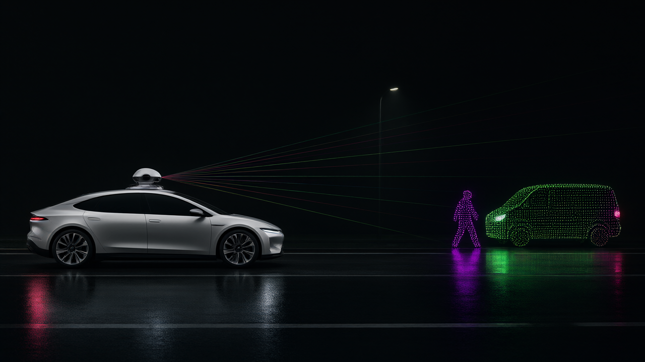
The research team at Huanghe Jiaotong University has developed a single-stage object detection model that fuses camera and LiDAR data to improve the reliability of identifying pedestrians, vehicles, and traffic participants. A critical achievement of the system is the LiDAR branch’s clustering accuracy, which reached 94.7 percent using a 0.3-meter clustering threshold. The system is designed to maintain performance in low-light conditions and environments where sensors typically struggle with sparse data or occlusions.
Technical Details
The visual branch is based on the YOLOv12 architecture. To address the weakness of Area Attention in detecting slender targets like traffic cones and pedestrians, the researchers embedded lightweight Coordinate Attention (CA) modules. This creates a complementary structure where Area Attention captures global context and CA provides precise pixel coordinate weighting. Additionally, the team replaced the standard Intersection over Union (IoU) loss function with Complete IoU (CIoU) to improve bounding box regression.
The LiDAR pipeline utilizes the PCL library to minimize computational load, avoiding additional deep learning networks. The process follows four steps:
- Pass-through filtering and voxel grid downsampling to remove noise and redundancy.
- Calculation of geometric features, including vertical height, point cloud density, surface normal vector, and average distance.
- Euclidean distance clustering with a 0.3-meter threshold to prevent over-segmentation of vehicles or under-segmentation of pedestrians.
- Computation of target matching confidence based on valid matched points to output 3D bounding box coordinates.
Background & Context
Autonomous vehicle perception typically relies on cameras, LiDAR, millimeter-wave radar, and ultrasonic sensors. While cameras provide rich texture, they are vulnerable to weather and light changes; conversely, LiDAR provides precise 3D distance but suffers from sparse point clouds and computational bottlenecks. Previous single-modal or multi-modal fusion methods often lacked robustness during dynamic driving conditions or suffered from weak feature coupling.
Significance & Outlook
By implementing a scene-adaptive decision-level dynamic weight fusion strategy, the system avoids low-level coupling and instead fuses independent single-modal results. This approach allows the vehicle to better navigate complex scenes by leveraging the complementary strengths of visual and spatial data.
Get our weekly technology intelligence — free
Receive an infographic that lets you judge at a glance whether each field’s analysis report is worth reading.
Subscribe Free — Weekly Tech Intelligence
By subscribing, you’ll receive Troy-Technical’s weekly technology intelligence newsletter.
- Your email and selected fields are used only to deliver the newsletter.
- We never share your information with third parties.
- You can unsubscribe anytime via the link in each email.
See our Privacy Policy for details.
Takes about a minute · Unsubscribe anytime